 St.Niklaas
Validation date: 06 02 2012
Updated on: 03 03 2013
Views: 5180
See on the interactive map:
51°10'25"N 004°11'44"E
Runway ../.. - ...x..meters - grass
St. Niklaas airfield (Dutch: vliegveld St.Niklaas or vliegveld 'De Ster') was an airfield west of Antwerp in Belgium.
The airfield was a military airfield, ordered by the Belgian Air Force on 10 October 1939. After the German invasion the airfield was pressed into service with the Luftwaffe and upgraded. It received concrete taxiways and dispersals.
It is not known exactly what happened to the airfield during and after the war. Little or no aircraft used it. The airfield was not listed on the list of Allied Advanced Landing grounds.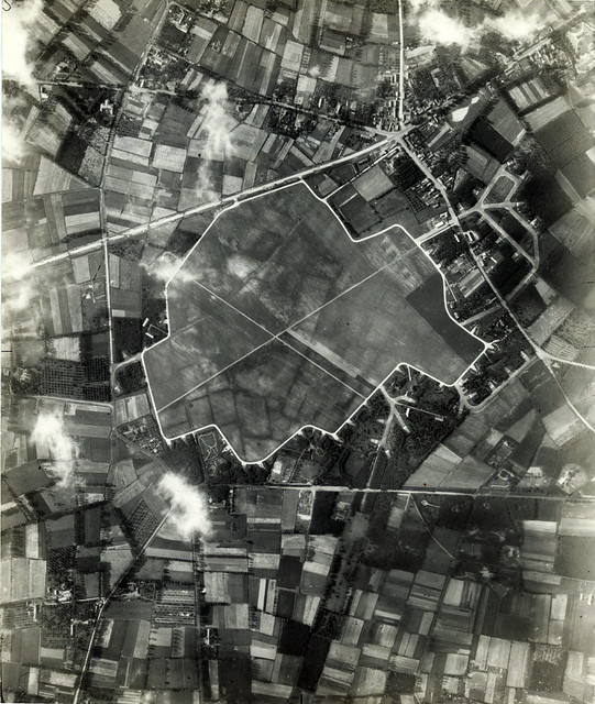
July 18, 1944 photo of St. Niklaas airfield by 14th Squadron, 7th Photo Group, Lt John S Blyth flying Spitfire MK XI MB948 at an altitude of approximately 30,000ft (Flickr).
In 1960 it was destined to become an industrial area, but in 1965 it got its final designation: recreation. Around 1970 a pond was dug out of the central flying field for the constuction of the E-17 highway (over one million cubic meters of soil were moved) Later, around 1980 the terrain was finally converted into a recreational area.
The location of the airfield in 2009. Although the roads have not changed, the former airfield is unrecognisable (Google Earth).
Thanks to JV for pointing out this airfield!
 St.Niklaas